Can you hike Seoul by subway? Start by choosing the walk
Seoul’s answer to the city-break hiking question is unusually concrete. The Korea Tourism Organization describes the Bukhansan branch of the Seoul Hiking Tourism Center as a short walk from Bukhansan Ui Station, with multilingual course information, maps, lockers, a lounge, and rental equipment for international visitors. That gives a traveller a public starting point for information. It does not turn every nearby ridge into a casual walk, and it does not replace checking the current route before leaving.VisitKorea: Seoul Hiking Tourism Center, Bukhansan Branch
Begin with the shape of the day you want. A summit route asks for an uphill and a descent through mountain terrain. A dulle-gil, or perimeter trail, can keep you lower on the mountain and may suit a different itinerary. An urban ridge walk can place city walls, neighbourhood streets, or a café district beside the route. Those are separate travel choices. A photo of Baegundae, a forest deck, or the Seoul skyline does not tell you which one you have selected.
The Seoul Metropolitan Government’s Bukhansan guide makes the distinction visible. Its three sample trails are labelled beginner, intermediate, and advanced or expert, with different terrain and estimated walking times. The guide places the centre close to Bukhansan Ui Station, then shows that the mountain continues well beyond the station exit. Use the station as the beginning of your research, not as a difficulty rating.Seoul Metropolitan Government: Bukhansan Hiking Tourism Center guide
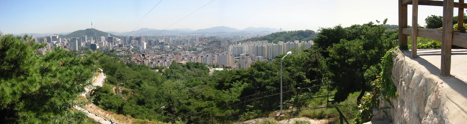
For a first Seoul hike, compare route types before peaks
If Baegundae is the image that brought you here, read the route record before treating it as a default first hike. Visit Seoul lists the Baegundae–Ui Gugok Trail at 9.98 kilometres, an estimated 4 hours and 20 minutes, and advanced difficulty. It begins from the Bukhansan Ui Station side, but it remains a mountain route with a long day’s worth of decisions. The official estimate is a planning reference, not a promise about your own pace, queues, weather, or descent.Visit Seoul: Baegundae–Ui Gugok Trail
A lower Bukhansan option creates a different first experience. Visit Seoul describes Uiryeong-gil as a 6.42-kilometre course with gentle ascents and descents, an estimated two hours, and an easy difficulty label. Its listing starts from Exit 1 of Bukhansan Ui Station. That is useful because it separates two common visitor wishes: reaching the Bukhansan area and reaching a particular summit. You can satisfy the first without assuming that the second belongs on the same day.Visit Seoul: Bukhansan Dulle-gil Uiryeong-gil
Inwangsan offers another scale. Visit Seoul’s Seodaemun section of the Inwangsan Dulle-gil is listed as 3.43 kilometres, about two hours, with easy and normal sections. A route description can help you compare the scale of a forest-and-neighbourhood walk with a summit day, yet the listing should not be read as a personal recommendation. Open the current official map, read the route sequence, and decide whether the actual entry and exit points fit the rest of your Seoul plan.Visit Seoul: Inwangsan Dulle-gil Seodaemun Section
CHOOSE YOUR NEXT QUESTION
Continue through the issue
A nearby station does not settle the terrain question
Gwanaksan shows why the name of a mountain is too broad to plan from. Visit Seoul says its hiking routes can be grouped into seven major courses with differing characteristics, slopes, and hazardous sections. The same official listing warns that rocky ridges can become slippery after rain and places Gwanaksan Station Exit 1 close to the mountain area. A convenient approach is one fact in the plan. Surface condition, route choice, and the way back are separate facts to verify.Visit Seoul: Gwanaksan Mountain
This is where a first-time visitor can make the most useful edit to an itinerary. Replace “hike Bukhansan” with a route name, intended direction, official difficulty label, and intended exit. Replace “go early” with the time you need to leave the mountain before daylight, transport changes, or another fixed booking. Replace “we can decide at the top” with a written plan for a loop, an out-and-back, or a traverse into a different district.
Bukhansan’s official visitor record says that closures can occur abruptly in adverse weather. That line matters more than a creator’s clear-sky edit or a saved map from a previous season. Keep the mountain’s Korean name, the station name, and the official route page accessible before you leave reliable signal. If a current closure, warning, or route condition changes the plan, choose another public walk or move the hike. A changed itinerary is ordinary travel planning.VisitKorea: Bukhansan National Park, Seoul District
Bukhansan has a route ladder, not one tourist experience
The Bukhansan centre guide identifies a beginner Sogwicheon Trail, an intermediate Youngbong Peak Trail, and an advanced or expert Baegundae Trail. It also says the final approach from Baegunbongammun Gate to Baegundae Peak includes a rock-cliff section where hikers hold a rope and watch their footing. The page supports a route distinction, not a rule about who should attempt it. Let the current official route information and your own preparation determine whether that section belongs in your day.Seoul Metropolitan Government: Bukhansan route difficulty and rope section
Write down the exact route before deciding whether to rent anything. Rental boots, poles, gloves, clothing, lockers, and information can lower the friction of travelling without hiking gear. They do not establish that a route is open, that a particular size is available, or that equipment is appropriate for every surface and condition. Treat the rental desk as a place to ask questions. Confirm reservation requirements, return arrangements, and the day’s operating information through the centre’s live official channel.
The KTO listing describes the centre’s gear-rental and visitor-support services, including boots, attire, trekking poles, gloves, crampons, lockers, and a lounge. It is evidence that these services have been offered for foreign visitors. It is not a permanent inventory list or a same-day availability guarantee. Build a plan that still works if one item, one size, or the centre itself is unavailable.VisitKorea: services at Seoul Hiking Tourism Center, Bukhansan Branch
Check the morning conditions, then decide whether the route still fits
Korea’s Meteorological Administration publishes current severe-weather status and separate issuance criteria for wind, heavy rain, snow, cold waves, heat waves, and Asian dust. Its published criteria recognise mountain areas separately for strong wind and snowfall. The practical editorial point is simple: consult the current KMA forecast and warnings on the day of the walk. Do not turn the published thresholds into a personal medical or fitness rule, and do not assume that a Seoul street forecast describes an exposed ridge.Korea Meteorological Administration: current severe weather status
Weather is only one live variable. Check the relevant official park or city route page for closures or notices. Check the centre if your plan depends on rental gear, storage, or a programme. Check your chosen navigation and transit service for the day’s station, transfer, and service information. Carry a charged phone, an offline reference, water and food appropriate to your own plan, and enough time to reverse course without turning the descent into a race.
The Seoul centre guide includes route information, trail difficulty labels, gear-reservation information, and access directions from major Seoul stations. It therefore works well as a starting document for Bukhansan planning. It cannot confirm the present state of every path, the day’s train timetable, or the condition of a rock surface after a change in weather. Leave those time-sensitive facts open until the morning you travel.Seoul Metropolitan Government: Bukhansan centre planning guide
Plan the descent before the summit photo
A route card is more useful than a vague promise to follow the crowd. Put the official route name at the top. Add the Korean mountain and station names beneath it. Mark the intended entrance, the intended exit, and whether you expect to return to the same station. If your route ends in another district, identify what happens to a bag, a companion, a rental item, and the rest of your day before you leave the accommodation.
Visit Seoul’s Bukhansan route listings demonstrate how much route endpoints can vary. The Baegundae–Ui Gugok listing begins and ends through the Bukhansan Ui and hiking-centre side, while other Bukhansan listings use Gupabal, Bulgwang, or Dobong approaches. The mountain name alone cannot tell a traveller where a hike begins or finishes. Link the article’s route card to the exact official record that matches the chosen route.Visit Seoul: Baegundae–Ui Gugok Trail route sequence Visit Seoul: Bukhansan Dulle-gil Uiryeong-gil route sequence
Give yourself permission to stop before the view you came for. The culture worth carrying home is not a compulsory summit or a performance of toughness. It is the feeling of a city where a train can bring you to a mountain decision, and where a sensible return can leave room for the rest of Seoul.
After the trail, keep the rest of the day optional
Hiking can lead to a meal, a bathhouse visit, a convenience-store stop, or a quiet train ride back. None belongs on a required checklist. Restaurants change. Bathhouse rules and booking arrangements vary. Alcohol is a personal choice. A traveller who wants a Korean food experience after a walk may want a short neighbourhood meal; another may prefer to save the bathhouse or temple programme for a separate day with enough time to understand its own rules.
VisitKorea presents the Seoul Hiking Tourism Center as a place for information, equipment support, storage, and rest before or after exploring Bukhansan. That public-service frame is more useful than a scripted post-hike ritual. Use the end of a hike to check what you need next: transport, a meal, rest, dry clothes, or a different wellness experience with its own conditions.VisitKorea: visitor support at Seoul Hiking Tourism Center, Bukhansan Branch
A Seoul hiking day succeeds when its route matches the day you actually have. The station matters because it makes a mountain possible. The route card matters because it tells you when to continue, when to change course, and how to get home with the rest of the city still waiting.
ISSUE COMPANION
The Seoul subway-to-trail verification card
Complete this from current official information before leaving. A saved screenshot from a previous trip is not a substitute for the day’s route and conditions.
- 01
1. Route identity
Record the exact official route name, mountain name in Korean, and route-page URL.
Do not plan from a summit name alone. - 02
2. Start point
Record the station, exit, neighbourhood walk, and official trail entrance.
Check the live transit service separately. - 03
3. Route shape
Mark whether the route is out-and-back, loop, or traverse.
A traverse can end far from your original station. - 04
4. Official route record
Save the listed distance, estimated time, difficulty label, and terrain notes.
They describe the route, not your personal pace or readiness. - 05
5. Descent plan
Write the intended exit, next station or bus connection, and daylight margin.
Keep a turn-around option. - 06
6. Current conditions
Check the relevant park or city notice plus KMA forecast and severe-weather information.
Change the plan if the current record no longer supports it. - 07
7. Centre and gear
If using the hiking centre, confirm its current operating information, reservation, inventory, size, return process, and storage needs.
Never assume availability from an older guide. - 08
8. Contact and fallback
Carry an offline route reference, charged phone, water, food, and a way to contact someone if travelling alone.
A lower route, a museum, or a neighbourhood walk can be the day’s fallback.
EVIDENCE & EDITORIAL RECORD
How this story was made
Turns subway access into a finishable-route decision with official difficulty distinctions, descent planning, equipment questions, and a day-of verification card.
Firsthand scope: No reporter hike, fitness assessment, gear test, live-transit check, or trail-condition inspection is claimed.
What we checked
- Visit Seoul lists materially different distances, estimated times, and difficulty for the cited Bukhansan-area routes.
- Seoul and KTO records document route infrastructure while KMA supplies the live weather-warning source.
Verify before you use this guide
- Current route notices, closures, surface conditions, and KMA weather status.
- Hiking-centre hours, rental inventory, transit, and a route appropriate to the reader's preparation.
Review dates describe editorial work, not a venue visit or publication date. Read the sourcing and corrections policy →
PRIMARY RECORDS
Records used in this guide
- Korea Tourism Organization: Seoul Hiking Tourism Center, Bukhansan Branch
- Seoul Metropolitan Government: Bukhansan Hiking Tourism Center guide
- Visit Seoul: Baegundae–Ui Gugok Trail
- Visit Seoul: Bukhansan Dulle-gil Uiryeong-gil
- Visit Seoul: Inwangsan Dulle-gil Seodaemun Section
- Visit Seoul: Gwanaksan Mountain
- Korea Tourism Organization: Bukhansan National Park, Seoul District
- Korea Meteorological Administration: current severe weather status